Insurance Documentation
Insurance Documentation
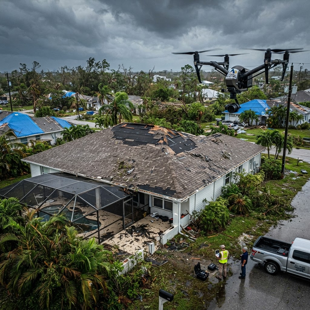
Rapid, comprehensive aerial documentation for insurance claims and property assessments. Before and after storm imagery, detailed damage documentation, and insurance-ready reports that strengthen your claim.
Aerial Documentation That Strengthens Your Insurance Claim
When severe weather strikes the Gulf Coast, property owners face a race against time to document damage for insurance claims. The quality and thoroughness of your documentation can make the difference between a claim that is approved quickly and one that is delayed, disputed, or denied. Drone-based insurance documentation provides the comprehensive, objective evidence that insurance adjusters need.
3D Drone Services LLC specializes in rapid-response aerial documentation for insurance purposes. Our FAA-certified pilots can deploy within hours of storm clearance to capture time-sensitive evidence before repairs begin or evidence is lost. We serve homeowners, business owners, public adjusters, and insurance professionals throughout the Gulf Coast of Florida.
Our documentation includes high-resolution aerial photographs, 4K video, and detailed written reports that catalog all visible damage. This evidence is timestamped, geo-referenced, and organized in a format that insurance companies can easily review and verify.
Before and After Documentation
The most powerful insurance documentation includes before-and-after imagery. We encourage property owners to schedule a baseline inspection before storm season, so we have a complete visual record of the property's pre-storm condition. When a storm hits, we return to capture post-storm imagery for a direct comparison.
This before-and-after approach eliminates any ambiguity about whether damage was pre-existing or storm-related. Insurance adjusters appreciate the clarity this provides, and it significantly strengthens your claim. Even without a baseline inspection, our post-storm documentation alone provides comprehensive evidence of storm damage.
For properties that have already sustained damage, we can still provide valuable documentation. We capture imagery from multiple angles and altitudes, ensuring that every area of damage is thoroughly documented from perspectives that ground-level photography simply cannot achieve.
What Our Insurance Documentation Includes
Our insurance documentation service provides a comprehensive package designed to support your claim at every stage. This includes high-resolution aerial photographs of the entire property, 4K video flyovers showing the full scope of damage, close-up imagery of specific damage areas, and a detailed written report cataloging all findings.
We document roof damage including missing and lifted shingles, cracked and displaced tiles, compromised flashing, and impact damage from debris. We also document exterior damage to siding, gutters, fencing, landscaping, and outbuildings. For commercial properties, we can document damage to flat roofs, HVAC equipment, and building facades.
All imagery is geo-referenced and timestamped, providing verifiable proof of when and where the documentation was captured. Reports are organized by damage type and location, making it easy for adjusters to review and process your claim efficiently.
Rapid Response When You Need It Most
After a storm, time is critical. Debris cleanup and emergency repairs can inadvertently remove evidence of damage. Our rapid response team can be on-site within hours of storm clearance to capture documentation before any repairs begin.
We understand the stress and uncertainty that follows storm damage. Our team works efficiently to capture comprehensive documentation, and we prioritize delivery for insurance purposes—most documentation packages are delivered within 24 hours of the inspection.
Key Benefits
Frequently Asked Questions
We offer rapid response and can typically be on-site within hours of storm clearance. We understand that time-sensitive evidence must be captured before cleanup and repairs begin, so we prioritize storm-response deployments.
Ready to Get Started?
Contact us today for a free consultation and custom quote. Our team is ready to help with your insurance documentation needs.
Call 941-288-2614Get in Touch
Request Insurance Documentation
Fill out the form below and we'll get back to you within 24 hours with a custom quote.

